
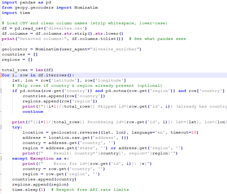
This project solves a classic data enrichment problem: turning raw GPS coordinates into meaningful location data. I built a Python pipeline that takes a CSV of scuba diving sites (latitude/longitude) and enriches it with country and region metadata using the Nominatim geocoding service (OpenStreetMap).
Key features of the system:
-
Automatic reverse geocoding: GPS → country + region.
-
Smart skipping: if a row already has country/region, it avoids unnecessary lookups.
-
Error handling: gracefully handles timeouts or missing data.
-
API safety: respects free API rate limits by adding timed delays.
-
Full integration: outputs a clean, enriched CSV (divesites_enriched.csv) ready for further processing or database import.
This project demonstrates how geospatial data can be enhanced with contextual metadata, making raw coordinates human-readable, searchable, and usable for downstream applications like travel platforms, mapping dashboards, or AI-driven content pipelines.
Have an idea that needs to work?
Discuss the next practical step with De Wilde ICT Solutions.
Contact us